- Region
- Águilas
- Alhama de Murcia
- Jumilla
- Lorca
- Los Alcázares
- Mazarrón
- San Javier
-
ALL AREAS & TOWNS
- AREAS
- SOUTH WEST
- MAR MENOR
- MURCIA CITY & CENTRAL
- NORTH & NORTH WEST
- TOWNS
- Abanilla
- Abarán
- Aguilas
- Alamillo
- Alcantarilla
- Aledo
- Alhama de Murcia
- Archena
- Balsicas
- Blanca
- Bolnuevo
- Bullas
- Cañadas del Romero
- Cabo de Palos
- Calasparra
- Camping Bolnuevo
- Campo De Ricote
- Camposol
- Canada De La Lena
- Caravaca de la Cruz
- Cartagena
- Cehegin
- Ceuti
- Cieza
- Condado de Alhama
- Corvera
- Costa Cálida
- Cuevas De Almanzora
- Cuevas de Reyllo
- El Carmoli
- El Mojon
- El Molino (Puerto Lumbreras)
- El Pareton / Cantareros
- El Raso
- El Valle Golf Resort
- Fortuna
- Fuente Alamo
- Hacienda del Alamo Golf Resort
- Hacienda Riquelme Golf Resort
- Isla Plana
- Islas Menores & Mar de Cristal
- Jumilla
- La Azohia
- La Charca
- La Manga Club
- La Manga del Mar Menor
- La Pinilla
- La Puebla
- La Torre
- La Torre Golf Resort
- La Unión
- Las Palas
- Las Ramblas
- Las Ramblas Golf
- Las Torres de Cotillas
- Leiva
- Librilla
- Lo Pagan
- Lo Santiago
- Lorca
- Lorquí
- Los Alcázares
- Los Balcones
- Los Belones
- Los Canovas
- Los Nietos
- Los Perez (Tallante)
- Los Urrutias
- Los Ventorrillos
- Mar De Cristal
- Mar Menor
- Mar Menor Golf Resort
- Mazarrón
- Mazarrón Country Club
- Molina de Segura
- Moratalla
- Mula
- Murcia City
- Murcia Property
- Pareton
- Peraleja Golf Resort
- Perin
- Pilar de la Horadada
- Pinar de Campoverde
- Pinoso
- Playa Honda
- Playa Honda / Playa Paraíso
- Pliego
- Portmán
- Pozo Estrecho
- Puerto de Mazarrón
- Puerto Lumbreras
- Puntas De Calnegre
- Region of Murcia
- Ricote
- Roda Golf Resort
- Roldan
- Roldan and Lo Ferro
- San Javier
- San Pedro del Pinatar
- Santiago de la Ribera
- Sierra Espuña
- Sucina
- Tallante
- Terrazas de la Torre Golf Resort
- Torre Pacheco
- Totana
- What's On Weekly Bulletin
- Yecla


- EDITIONS:
 Spanish News Today
 Alicante Today
 Andalucia Today
PR-MU 88 Route 33 a 7km walk between La Unión and Portmán
A seven-kilometre walk through the mountains and history of Portmán and La Unión
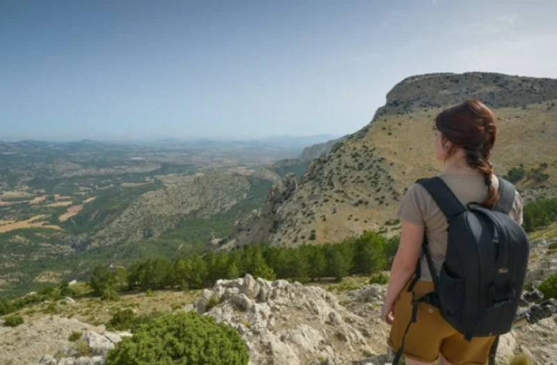
The Carretera del 33 is a seven-kilometre walk through the mountains of the Sierra Minera between La Unión and the coastal town of Portmán, taking walkers on a journey through the spectacular countryside of the hills 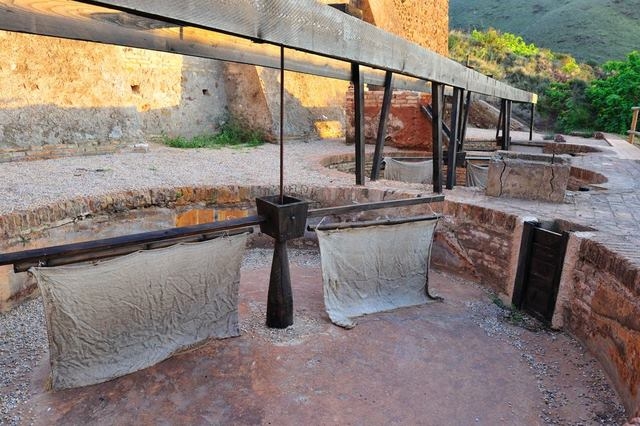 but also through the history of the mines in this part of the Costa Cálida.
The road was built in 1933 (hence its name) in order to provide direct links from the main mines in the Sierra to the port in Portmán, and at the same time provided employment for miners who had lost their livelihoods as a result of the general economic slump in the 1920s. When completed it soon formed the backbone of the mining industry of Cartagena and La Unión, and quickly became one of the best known features of the area. Nowadays it is very popular with walkers, particularly those who are looking for a day out from their bases in nearby La Manga Club or on the shores of the Mar Menor. Despite its route through the mountains it is described as “easy”, and usually lasts approximately three hours.
The preferred direction in which to tackle the Carretera del 33 is to start from the Parque Minera in La Unión, 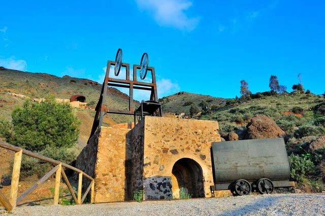 well equipped with drinking water and, in summer, ideally early in the morning. This is because there are no trees to provide shade along the way, and sun cream is also strongly recommended.
The road begins next to the entrance of the Parque Minera in the carpark, and soon takes walkers to signposts showing the start of the route towards the Agrupa Vicenta mine, basically uphill. These signs are located next to a restored kiln, one of hundreds which were used for roasting the minerals extracted from the mines and increasing their metallic properties.
As the path climbs into the hills there are panoramic views out over La Unión and the hill known as Cabezo Rajao, and before the path reaches the Agrupa Vicenta mine it is also possible to see the “Lavadero” of the Mina Remunerada. This was used to separate out the tin extracted from the mine for processing, and it was in operation between 1920 and 1957.
Further away from the path the Serpentín is also visible. This is a huge zig-zagging chimney which winds its 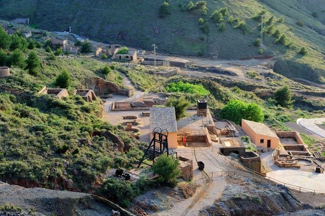 way up the hill from the Trinidad de Rentero lead foundry, the intention being for the smoke to cool down on its way out and for particles of lead to accumulate on the walls of the pipe. As a result the fumes were cleaner when they were released into the atmosphere, and at the same time it was possible to collect the accumulated lead from the interior of the chimney.
The walk then continues on its upward path to the Agrupa Vicente mine, the only one of its kind to have been turned into a museum in the Region of Murcia. Pyrites were mined here from 1869 until the middle of the 20th century, and the scene inside the vast underground chambers is a breathtaking one, including an interior lake 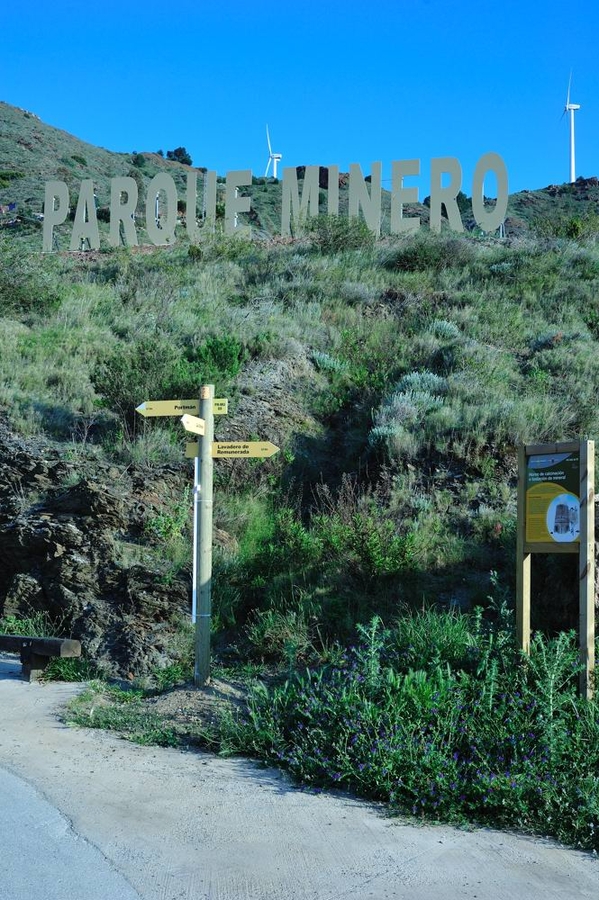 where the water has been turned red by the effect of the pyrites. The mine is only visitable by prior reservation, and is well worth returning to: an option could be to enjoy a good lunch after the walk and then come back to the mine in the afternoon. Click for more information: Parque Minero/ Mina Agrupa Vicenta
The next stop is the Polvorin, or gunpowder store, on the left of the path after the Agrupa Vicenta mine. Part of this is now used as a chapel while another area houses a small cafeteria, and the path then carries on uphill to the Pablo y Virginia mine and a “mirador” or viewing point looking back towards La Unión. From here it’s possible to return to the starting point down a Rambla or carry on towards Portmán.
The highest point on the walk is now reached, and the gradual descent begins on an earth track with the Cuesta del Gato to the right. This is a path which leads to the La Cuarta tin mine, while on the left is the Collado de las Lajas which goes up to the Sancti Spiritus area, where gigantic wind turbines dominate the skyline.
The road then leads down to an area known as La Crisoleja, where at last there is some greenery in the form 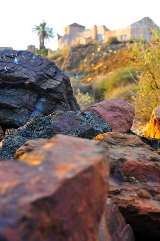 of pine trees and shrubs. This greenery should not belie the fact, though, that La Crisoleja was one of the centres of mining activity, due to the volcanic activity which produced dacites and trachyandesites. The landscape here is coloured red and ochre.
The route then zig-zags south past the Corta de San José quarry, where there were originally a number of underground pyrite mine shafts with names like Amable, Lolita, Constancia and Balsa, but later in the 20th century these were removed from the landscape by the advent of open-cast mining. This technique also obliterated the Carretera del 33, and the white and yellow route markings lead walkers to the east of the quarry before rejoining the road south of the quarry next to more old roasting kilns.
Approximately 400 metres further on there is a surprise in the dry landscape: water! A small stream flows unexpectedly out of the hillside, the product of a marble mine just above the level of the road, and not much further on the Carretera del 33 joins the road which brings motor vehicles from La Esperanza and La Unión to Portmán. From here it’s just another 400 metres to the town, where if walkers haven’t made other arrangements a bus can be caught back to the centre of La Unión. ( Click for bus timetables La Unión-Portmán)
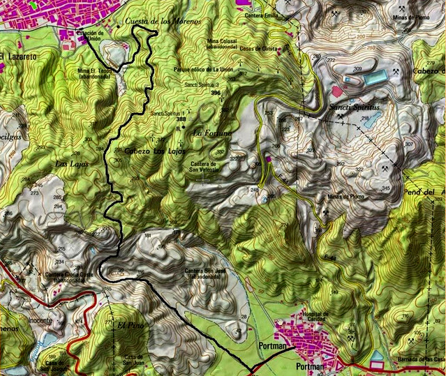 The Carretera del 33 is part of the regional network of rambles and walks, and is catalogued as PR-88. The route is marked throughout by two horizontal painted stripes, the top one white and the bottom one yellow.
Groups of walking enthusiasts can contract the services of a guide from the Fundación Sierra Minera to explore other areas of the Sierra. The Sierra Minera is riddled with mineshafts and old mineworkings, so in order to avoid accidents, the Foundation will guide groups of walkers through this interesting area.
Click for more information about visiting the La Unión municipality: La Unión


